Research
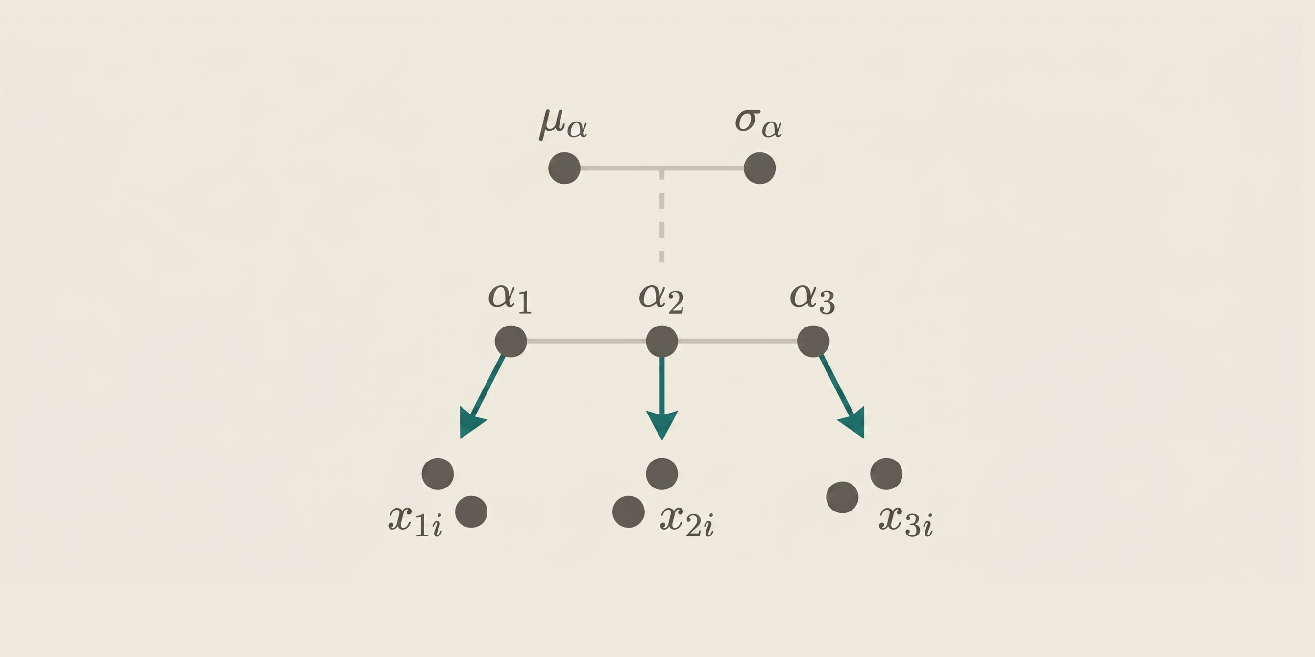
Bayesian Hierarchical Models
Application of Bayesian hierarchical models to characterize spatio-temporal patterns in environmental exposures, health outcomes, and ecological processes to support robust risk assessment and evidence-based decision-making.
Approximate Bayesian Inference
Development of scalable spatio-temporal Bayesian models using Integrated Nested Laplace Approximation (INLA) to allow fast and accurate inference, overcoming the computational limitations of traditional MCMC methods.
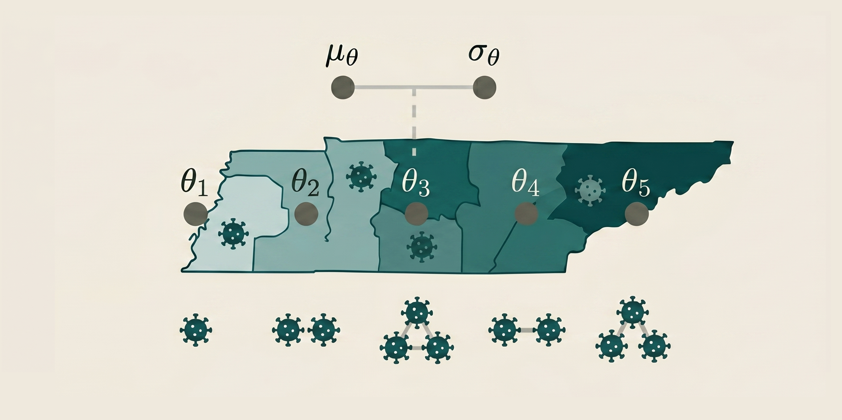
Disease Mapping
Bayesian disease mapping in settings where data are aggregated over small or irregular spatial units, and differences in population size and spatial structure can make standard approaches unstable or misleading.
Spatial & Environmental Statistics
Bayesian hierarchical models to quantify spatial variation in environmental exposures and associated health risks, integrating heterogeneous data sources (e.g., environmental, demographic, and health records) within a coherent probabilistic framework.
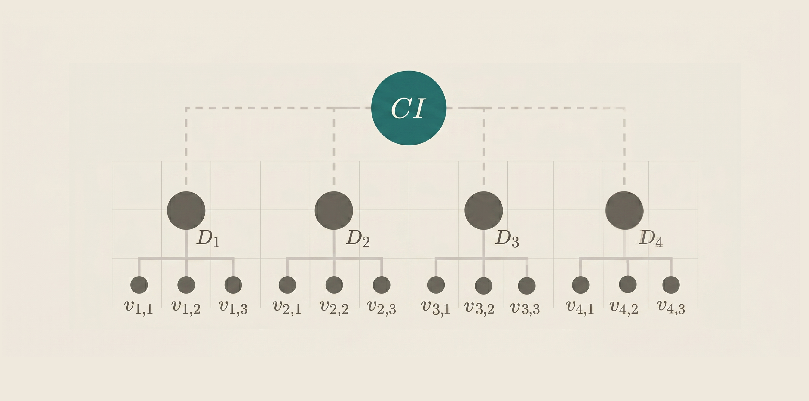
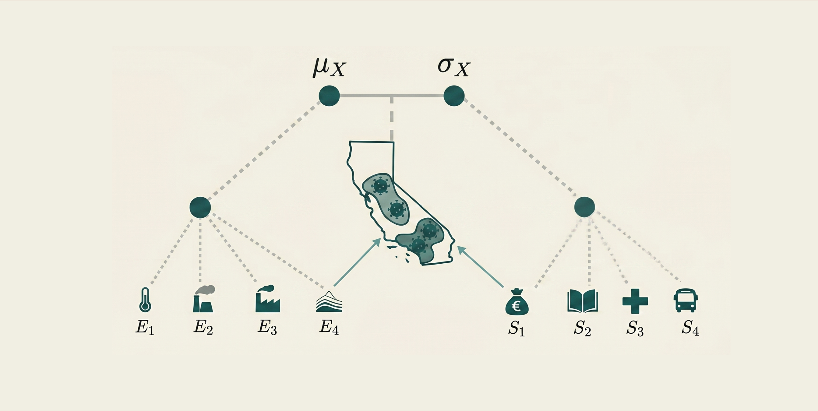
Composite Indicators
Spatial Bayesian latent factor models to construct composite indicators of climate and environmental vulnerability in urban areas, integrating multiple data sources and quantifying uncertainty in a coherent probabilistic framework.

Geospatial Data Visualization
Turning complex spatial analyses into web-based mapping applications and interactive visualizations that make results easier to explore, interpret, and use for decision-making.