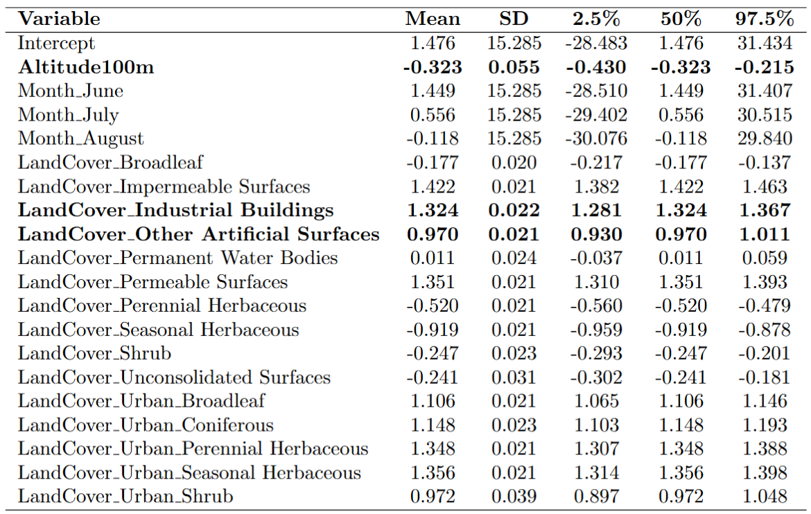
- Altitude data sourced from the Geoportal of Emilia-Romagna Region (DTM 5x5)
- Month of remote sensing image acquisition
- Land cover categories and urban classifications were derived from ISPRA datasets (ISPRA Land Use and Land Cover). These covariates represent the land cover category of each 30m pixel (reference category: Coniferous).
A) Bayesian Spatially Varying Coefficient (SVC) Model for LST
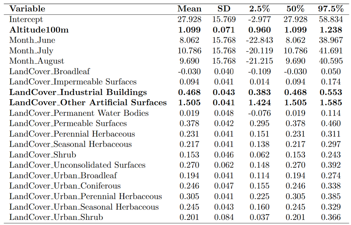
B) Bayesian SVC Model for SUHI